I'm slowly getting back into hiking. Although I seem to feel tired all the time, and I am overweight (72.2 kg). But it feels good to get back into the woods.
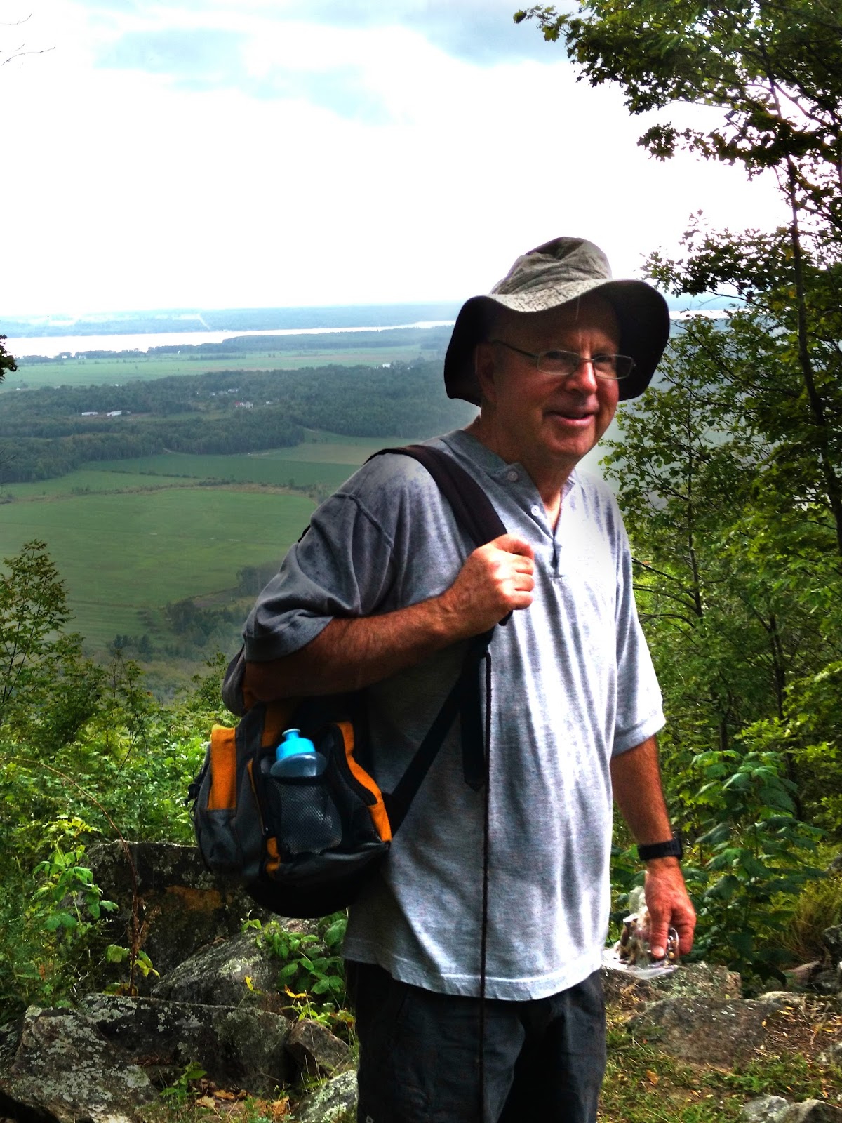
Saturday morning, I went on a lovely early morning hike with Jivka and three other hikers.
It was a nice hike, really steep in the first part, but easy after that.
I hadn't been on that trail in a couple of years, so it felt good.
However, I was reminded that I am, sadly, fat.
I had never ever thought I would ever be a fat person. But I am.
Anyway, the hike was still great.
Showing posts with label Gatineau Park. Show all posts
Monday, July 15, 2019
Wednesday, May 22, 2019
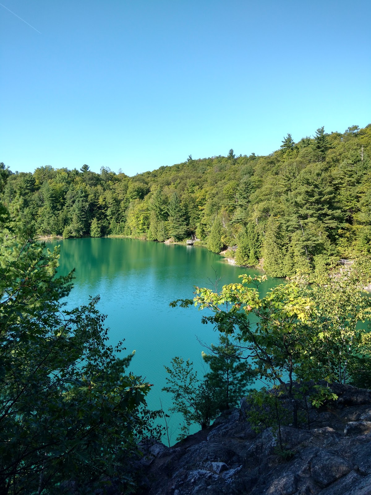
8km Hike - Marie-Burger to Pink Lake
Sunday, May 19, 2019 marks the day I got back into hiking after a year or so hiatus.
I used to regularly lead big group hikes in Gatineau Park, but gaining a wonderful but busy full-time job, and then my mother's illness, took their toll and I pretty much stopped hiking. (This could lead to a whole other topic about the vital importance of self-care when providing care to others, but let's stick to the hike for now!)
So, anyway, I posted a hike to Pink Lake from Marie-Burger/Ch. de la Mine. It was supposed to be a 10km to 12 km hike, but since we had a small group, we collectively were willing to try new routes. Because I started from Marie-Burger instead of rue Quartz, we were very close to a small dirt trail the was a huge shortcut to trail #15. We took that, then the #15 to the #35, then most of the way around Pink Lake, til we got to a little trail off to the right. I did not know the trail, and had gotten a group lost around there once, but a member of our group was quite familiar with the trail, so we were willing to try it.
The trail led us back to the #25, from where we got to the paved trail #5, went left, back up to the #15, and then the shortcut back to the cars.
In total, is was just under 8 km.
It was a lovely hike, shorter than planned, but to be honest, I am not a fan of hiking on paved trails ;)
Here is the map that I think shows our route:
I used to regularly lead big group hikes in Gatineau Park, but gaining a wonderful but busy full-time job, and then my mother's illness, took their toll and I pretty much stopped hiking. (This could lead to a whole other topic about the vital importance of self-care when providing care to others, but let's stick to the hike for now!)
So, anyway, I posted a hike to Pink Lake from Marie-Burger/Ch. de la Mine. It was supposed to be a 10km to 12 km hike, but since we had a small group, we collectively were willing to try new routes. Because I started from Marie-Burger instead of rue Quartz, we were very close to a small dirt trail the was a huge shortcut to trail #15. We took that, then the #15 to the #35, then most of the way around Pink Lake, til we got to a little trail off to the right. I did not know the trail, and had gotten a group lost around there once, but a member of our group was quite familiar with the trail, so we were willing to try it.
The trail led us back to the #25, from where we got to the paved trail #5, went left, back up to the #15, and then the shortcut back to the cars.
In total, is was just under 8 km.
It was a lovely hike, shorter than planned, but to be honest, I am not a fan of hiking on paved trails ;)
Here is the map that I think shows our route:
Sunday, June 25, 2017
Ysterday afternoon marked the first hike in Gatineau park for me and Lola for this season. I know - it's crazy late in the year, but the weather and my work schedule have not been cooperative :)
But, yesterday, Sarah, Gryphone, Lola and I managed to get out for a 5.45 km hike. It was actually supposed to be 3 or 4 km, but I under-estimated the length of the Skyline Trail (trail #6).
This is a good hike - it is a workout, but not too long. Park at P7, take trail #30 up to the first lookout, go left and then right at the sign for the Skyline Trail. Stay on trail number six for the loop! (see the map below).
Lola and Grypon at one of the lookouts along the loop:


And the two pooches were so tired, they slept during the drive back home:
e
But, yesterday, Sarah, Gryphone, Lola and I managed to get out for a 5.45 km hike. It was actually supposed to be 3 or 4 km, but I under-estimated the length of the Skyline Trail (trail #6).
This is a good hike - it is a workout, but not too long. Park at P7, take trail #30 up to the first lookout, go left and then right at the sign for the Skyline Trail. Stay on trail number six for the loop! (see the map below).
Lola and Grypon at one of the lookouts along the loop:


And the two pooches were so tired, they slept during the drive back home:
e Saturday, October 15, 2016
Leading a Hike on Wolf Trail
Not much to say about this one - I've done Wolf Trail many times now, and this was my third this year. It is an awesome trail, really invigorating with great lookouts and not too long. Though considered the most challenging trail in Gatineau Park, I actually don't find it too bad. Just go slow, take the right side arm up, and descend on a nice, easy route. For more details of Wolf Trail (#62 from P13), see my earlier post here.


Saturday, September 17, 2016
Hike P11 (O'Brien Beach) to MacDonald Bay in Gatineau Park

Two Wednesdays ago, on September 7th (2016), three of us went for a lovely afternoon hike in Gatineau Park again. I wanted to scope out a possible route for one of my own hikes that I lead on Sunday mornings, and since parking is now free (since it's off season), I thought we'd follow a trail from the O'Brien beach parking lot (P11) on Meech Road.
![]() |
| Jivka at the bay |
But, the trail is wide enough to walk side-by-side, but still has some rocks and roots, and it wends past a house and field, and skirts Meech Lake a lot of the way. A good walk for dogs!
![]() |
| The clothes of the mountain-biking snorkler |
Monday, September 5, 2016
12km Hike to Pink Lake
![]() |
| The group at Pink Lake |
The Route:
Yesterday I took the group (eleven of us counting me) from P7 on Chemin Kingsmere to Pink Lake, via Chemin Swamp and then trails #15 and #35.
Description, Distance, Difficulty:
This is not a tough hike, but due to the distance of 12 km and some steep but short hills, I wouldn't recommend it as a first-time hike. You want to have some level of fitness to do this.
The trail is shaded but wide enough to walk two or three side-by-side. It's not very technical as it isn't narrow and windy, but there are some roots and gravelly rock. There are rolling hills, some are steep but they're not long so it's an easy recovery.
One thing, though - this trail is more down on the way to the lake, and more up on the way back. I mention this because I usually like to do the hard part in the beginning, and then coast on the way back!
Trail #15 is popular with mountain bikers (it's a great mountain bike trail!), so hikers will see a few bikers.
Anyway - yesterday was a great hike. The weather was perfect - cool, then warm, and sunny with blue skies. Because the parkways were closed for Bike Day Sunday, we hikers had the lake pretty much to ourselves, since people couldn't drive.
Thursday, September 1, 2016
Hike from P12 in Gatineau Park (9 to 12km)
Although yesterday was August 31st (and today is already September!), the weather has continued to be hot but still inviting for us eager hikers.
I went out yesterday afternoon for our mid-week hike (Jivka, Gord, Nancy and I) to enjoy the outdoors, a little shinrin-yoku, and to get familiar with trails on which to lead our group hikes on the weekend.
Yesterday's route was really good because it is not one we've done often, and part of it, we had never done.
So, this hike was really not very long - only 8.5 km or so, but can easily be extended to 12 km by building in a visit to Western cabin for a break and to enjoy the lookout there.
However, it is rather challenging for the first 1/3 to 1/2 of the route because you go pretty much straight up on #40 and #2. It's quite steep on a wide, gravelly trail. But it's shaded, and, hey, it's not a race after all, so stop and take breaks as needed.
Once you hit trail #1, you are pretty much going to be making a slow, gentle, steady decline back down.
Trail #38 is really nice - it's a short, narrow single-track that is jungle-like and really has an ethereal beauty. I LOVED it.
Back to #40 - you've got a steep down-hill before making it back to the cars.
We covered this route in 2 hours (and one minute!), but we were pushing it. With a group, and a break, I'd say it's an easy 3 hour hike.
I went out yesterday afternoon for our mid-week hike (Jivka, Gord, Nancy and I) to enjoy the outdoors, a little shinrin-yoku, and to get familiar with trails on which to lead our group hikes on the weekend.
Yesterday's route was really good because it is not one we've done often, and part of it, we had never done.
The Route:
P12 parking lot. Take trail #40, stay left to take #2 (about 1.5 km in), Turn right on #1, then right on #62, right on #38, and left on #40 back to the parking lot.Description, Distance and Difficulty
So, this hike was really not very long - only 8.5 km or so, but can easily be extended to 12 km by building in a visit to Western cabin for a break and to enjoy the lookout there.
However, it is rather challenging for the first 1/3 to 1/2 of the route because you go pretty much straight up on #40 and #2. It's quite steep on a wide, gravelly trail. But it's shaded, and, hey, it's not a race after all, so stop and take breaks as needed.
Once you hit trail #1, you are pretty much going to be making a slow, gentle, steady decline back down.
Trail #38 is really nice - it's a short, narrow single-track that is jungle-like and really has an ethereal beauty. I LOVED it.
Back to #40 - you've got a steep down-hill before making it back to the cars.
We covered this route in 2 hours (and one minute!), but we were pushing it. With a group, and a break, I'd say it's an easy 3 hour hike.
Hike from Camp Fortune to Étienne Brûlé
On Sunday, I led my hiking group on a nice hike to the Étienne Brûlé lookout.On Sunday mornings during the summer months, the parkways in Gatineau Park are closed to cars so that cyclist can enjoy the road to themselves for "Bike Day Sundays". I think this is a great idea, but it does mean that many trailsheads are not accessible to us hikers (we cannot get to them by car). On the other hand, it is so wonderful to hike up to popular places and find them unpopulated because car-peeps just can't get there on Sunday mornings!
Anyway, on Sunday (August 28th, 2016) , I led a group of 10 hikers (yours truly included!) from Camp Fotune up to the really beautiful Étienne Brûlé lookout and picnic area.
Because I do the Early Riser hikes (for morning people like me), the gates to the Camp Fortune parking lot were still closed, so we parked on the side of the road just outside the gates (this is something a lot of people do).
The Route:
From Camp Fortune, we walked up the dirt road (follow signs for the Arienne Defi) up to the chalet/ main office. We took trail #9, and #3 to the lookout, then returned via route #1, #14 and #4.
Distance, Difficulty:
The total distance for this was 11.84 km or say, 12 km. A good distance for a morning hike. This is not such a tough route. #9 is rough and rocky and rooty, but not too steep and is quite doable. #3 is wider and gravelled. #1 is very wide and gravelled, and is not too hilly in this section. #14 and 4 are quite easy and all downhill. Friday, August 12, 2016
Some Hiking Photos
The group I was leading atop King Mountain, August 7
The group I was leading to the Carbide Ruins and O'Brien Beach, July 24th, 2016
Wednesday, August 3, 2016
Why I Love Leading Hikes
As you know, I moved to the Outaouais region of Quebec four years ago, and have been enjoying the many benefits of suburban outdoor life. Including lots of hiking and leisure in Gatineau Park.
I started leading hikes last year, and though I got a slow start this year, I've begun leading again, and I just LOVE it.It is a responsibility, but a good one.
What's involved in leading a hike:
What's to love about leading a hike?
This was last Sunday's hike. I had 13 hikers, and we had a great time in the woods! They especially liked the little leg on the unmarked trail from #9 to Keogan.
I started leading hikes last year, and though I got a slow start this year, I've begun leading again, and I just LOVE it.It is a responsibility, but a good one.
What's involved in leading a hike:
- Leading takes planning and foresight. I go out midweek to check trails and routes, and the conditions.You need to know your route, and really cannot lose a hiker!
- The participants' confort should be of some concern - describe your hike well before people join. Mention if it's a beginner, intermediate or challenging outing.
- Make sure in your description to remind people to dress for the outing (no sandals - you'd be surprised at the peeps who've turned up to my hikes wearing flip-flops!) and to bring snacks and water.
- You are committed to the hike, even if you don't feel like it on the day, you can't just bail.
What's to love about leading a hike?
- You are committed to the hike, even if you don't feel like it on the day, you can't just bail.
- You meet new people
- You provide people with the opportunity to get outside and move
- The participants are appreciative of your efforts
If you life in the area (or not) and want to join my hikes, you can find mine as well as others here on this Meetup Group http://www.meetup.com/ottawa-backpacking-club/
This was last Sunday's hike. I had 13 hikers, and we had a great time in the woods! They especially liked the little leg on the unmarked trail from #9 to Keogan.
Thursday, July 28, 2016
Great Hike from P7 to King Mountain (8km) (and a bear sighting!)
My mid-week hikes have now, finally, become a looked-forward to part of my week. I'll admit, it's taken me longer this summer to become enthusiastic about fitness. I haven't been rollerblading much, haven't been biking but once, and hiking was an effort.
I blame the long, cold spring (winter was quite mild this year) and the slow, tumultuous start to summer. Talking with different people, you see, I realize that I'm not the only one who got a late start.
But now that I'm back into it, I am really into it. No trying to talk myself out of going, no looking for any excuse to bail.
Yesterday's hike was amazing. Short, but challenging and, yep, I got a good face-to-face with a black bear. Actually, I've had a lot of bear sightings in Gatineau Park. Last year about four or five, and already two this year. It's always mid-week (not weekends), and always around the same time of day (4:30 pm).
This bear sighting was gorgeous, though. I think he/she had been sleeping in the leave or brush, because it was only when we'd stopped to spray ourselves with bug spray that, suddenly, we heard the rustle and up came the bear. He was pretty close (not too close), and the angle he was standing at and looking toward - side-view, looking away from me - I got to appreciate his beauty. A big body, and gorgeous beige snout. Such a photo-worthy shot. Sadly, I didn't have my proper camera, and didn't have time to get my phone camera ready before the bear turned and headed off.
We saw the bear about 30 minutes into our hike. We had just left trail #1 and started onto the winter part of trail #8 (about 1km before hitting Keogan cabin, this trail is to the left). After the bear encounter, we kept going on #8, staying straight where it intersects with #17.
It's a steep, challenging climb, especially as we were all going pretty quickly, but it was great. We came out at the road, turned left and walked to the King Mountain parking lot. Then we went into the loop a little, to the left, then left again at the hard-to-see trail #37.
The whole thing, including a 25-minute rest at the King Mountain picnic area only took us two hours and twenty-minutes, but left me feeling very tired, and very refreshed.
I blame the long, cold spring (winter was quite mild this year) and the slow, tumultuous start to summer. Talking with different people, you see, I realize that I'm not the only one who got a late start.
But now that I'm back into it, I am really into it. No trying to talk myself out of going, no looking for any excuse to bail.
Yesterday's hike was amazing. Short, but challenging and, yep, I got a good face-to-face with a black bear. Actually, I've had a lot of bear sightings in Gatineau Park. Last year about four or five, and already two this year. It's always mid-week (not weekends), and always around the same time of day (4:30 pm).
This bear sighting was gorgeous, though. I think he/she had been sleeping in the leave or brush, because it was only when we'd stopped to spray ourselves with bug spray that, suddenly, we heard the rustle and up came the bear. He was pretty close (not too close), and the angle he was standing at and looking toward - side-view, looking away from me - I got to appreciate his beauty. A big body, and gorgeous beige snout. Such a photo-worthy shot. Sadly, I didn't have my proper camera, and didn't have time to get my phone camera ready before the bear turned and headed off.
We saw the bear about 30 minutes into our hike. We had just left trail #1 and started onto the winter part of trail #8 (about 1km before hitting Keogan cabin, this trail is to the left). After the bear encounter, we kept going on #8, staying straight where it intersects with #17.
It's a steep, challenging climb, especially as we were all going pretty quickly, but it was great. We came out at the road, turned left and walked to the King Mountain parking lot. Then we went into the loop a little, to the left, then left again at the hard-to-see trail #37.
The whole thing, including a 25-minute rest at the King Mountain picnic area only took us two hours and twenty-minutes, but left me feeling very tired, and very refreshed.
Monday, July 11, 2016
A Beginner's Guide to Hiking in Gatineau Park
![]() |
| Carbide Ruins |
Hiking can be as intense or as leisurely as you like it.
First of all, know that Gatineau Park is quite big, but certainly not as large or as wild as some larger national parks (like Algonquin park, for example). and is great for all levels of outdoor seekers.
Next, know that YES, YOU CAN GET LOST in the park. It's happened before, especially in winter when eager-beaver snow-shoers or skiiers decide to wander off the trails. So, the moral of this story is: don't go off the marked trails.
Ok, enough blah-blah-blah, right?
Get started hiking in the Park.
1. Go to the Visitor Centre in Chelsea, at 33 Scott Road, and purchase (yes, purchase) a summer trail map. Later, when you get more experienced, or if you decide to ski in winter, you'll want a winter trail map. And why pay for the map? Don't they have free maps? Yep, there is a free map, but it is NOT a trail map, and will not really help you on the trails at all.
2. Be prepared. Make sure you have:
- your map
- good hiking shoes or boots (not sandals!)
- water. And more water. There are no fountains or stores, and you'll want to stay hydrated to fully enjoy your outing
- appropriate clothing for the weather
- bug spray and sun screen. Trust me, Deep Woods Off or something like it will be required to keep the starving mosquitoes at bay
- bear spray if you want - there ARE black bears in the park, I've seen them more than a few times. They tend to run away, and are not looking for a fight, but still, exercise caution
3. Next, plan your first hike. Choose a gentler trail, of shorter duration, and one that is popular so you will not be totally alone for long - this will help you not get lost, will ensure help is available if you sprain an ankle, and will also ensure that bears won't be a problem.
4. Some good first trails are: (click the title link to see my original posts and maps)
P7 to Keogan
Park at P7 (on Kingsmere Rd) and hike trail #33 & #1 up to Keogan. Keogan is a cabin. There is one little scenic lookout along the way. And there are clear signs - follow the sign to Keogan, then on return, follow the sign for P Kingsmere. This is about 8 km.
P10 to Carbide Ruins
option here of going to O'Brien Beach, or continuing on #36 to the Carbide Ruins. This is only about 6 km.
Chemin de La Mine to Pink Lake
Park at on Rue Quartz, just off of Chemin de la Mine in Hull. Cross the road, and walk on the bicycle path (#5) for about 1.5 km or so. Then go right, onto trail #15. Follow #15 to #35 following signs for Pink Lake. You can walk around the lake if you like, which would add 2 km to your route. Be very careful to pay attention to your trails and your turns so you don't go off course especially upon return. This is about 10 km without the lake loop.
As you get to know the park and the trails, as you meet more people, you will learn more trails and test yourself.
If you want to get into a hiking group, there is a great, very active Meetup Group (of which yours truly is a hike leader) called the Ottawa-Gatineau Adventurers.
Happy Hiking!
Thursday, June 30, 2016
Gatineau Park, Hike from P10 to the Carbide Ruins. Nudity Ensues.
Today was another hot one. Of course, I basked in the heat! I am a lover of the heat and humidity - probably because our winters are so long and our summers so short. But anyway - today was a GREAT day. I went to my brother's work BBQ for lunch, and then I met my two best hiking buddies, Gord and Jivka, at P10 for a little afternoon hike.P10 is accessed from Dunlop Road, which can be accessed from Meech Lake Road, Fortune Parkway turn.
Anyway, we arrived at P10 by 3pm, and began our hike by 3:15.
The P11 (O'Brien) parking lot is a paid lot during the summer due to it's beach access. P10, however, is totally free, and it's not a far hike at all from P10 to O'Brien - so if you feel like walking for 45 minutes or so to get there and save yourself paying parking, I recommend this hike.
The trail is very dry right now due to our unusually dry spring/ summer weather, and it's very easy to navigate. It's a bit rocky in parts, and it's a trail, not a road, so wear appropriate footwear. There are rolling hills to O'Brien, and then, if you continue past that lot, and press on, there is one or two steep hills, but very, very manageable.
We did press on, and went to the Carbide Ruins. For all of my hikes in the Gatineau Park, I'd never yet been to these famous ruins. I suppose because we usually start this trail at p11, and the ruins are too short a trip - we would always continue on to McDonald's Bay or to Healey. But this hike started further away, and so the ruins were a good destination today.
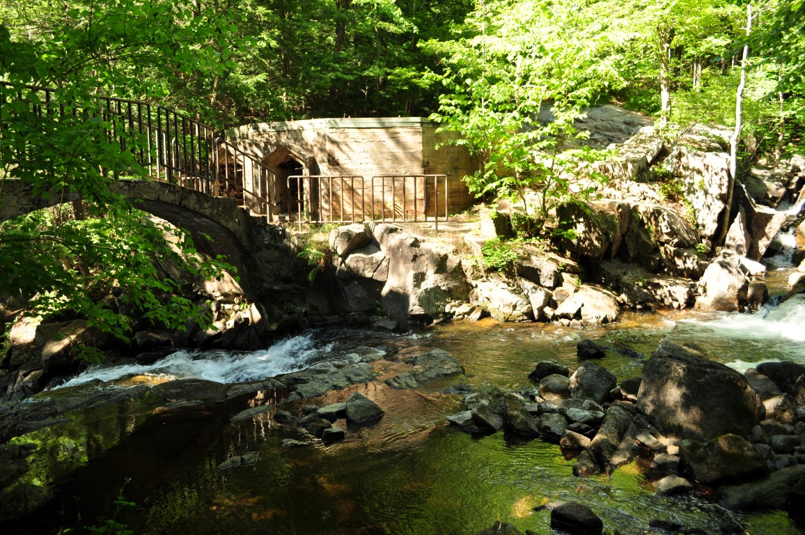
I'm so glad I stopped. The Carbide Wilson ruins are the ruins of the mill made by Thomas "Carbide" Wilson in 1907 (need to double check all this). Anyway, the waterfalls are lovely,, the ruins are atmospheric, and, well, despite the Park's efforts, there are still nudists!! We stumbled upon a few naked dudes and a lady, what joy!
That was today's hike - from P10 to the Carbide Wilson Rinds and then back again.
OOH, and I've actually started to enjoy photography again! I brought my real camera - my Nikon D90 - along for the trek, and got some nice shots of Gord and Jivka.
Wednesday, June 22, 2016
Hike in Gatineau Park, p10 to Keogan
This afternoon, Lola and I met our two hiking buddies, Gord and Jivka, to go for a lovely late afternoon hike in Gatineau Park.Due to the chilly spring, and the hot summer, we really haven't gotten out as much as we would have liked, but the tide has turned and we are gung ho for sure!
The hike was soo good today. It was a familiar route, from P10 (near Camp Fortune), taking trail #32 up to Camp Fortune, and forking right onto trail #9 until just before a little wooden bridge. At this point, we turned right onto an old, unmarked trail the takes you directly to Keogan cabin (on this trail, keep the swamp/water to your right, when you get to an obvious T choice, go right (downhill).
It was a really enjoyable hike, great conversation, with the added benefit of actually tiring Lola out a bit!!
This is an intermediate type hike, I'd say. Some of the trails are tricky to find, and they are narrow and rocky, and steep, in places. Still, it's a great hike of between 8 and 10 kilometres, and took us about 2.5 hours to do.
Don't be shy - hit the hills with your hiking boots on!
This map below is the route we followed, with the slight exception that, on our return trip, we left trail #32 just past the lake and made out way back to the cars by the easier route of the road! (This map was logged last year, and I have been lazy about setting my phone to log my recent routes. But it IS the same route, except for, like i said, we left 32 on the way back and walked parallel to it on the road).
Saturday, April 16, 2016
Lola's First Hike
Today was the most gorgeous Saturday since, well, since autumn. This month, the weather has been a bit chillier and snowier than usual for April, but this weekend is above and beyond normal for this time of year. The temperature was 16 degrees Celsius, the sky was blue and the sun was bright! So, Jivka and I, along with two other friends headed out on a great first hike of the season. And - I brought Lola along for her first hike EVER. We had a great time.
We parked on rue Quartz, just off of Chemin de la Mine in Hull, and we walked along the bike path to trail #15 (it's on the right, about 1 km in), then trail #35 to Pink Lake. We did not walk around the lake this time out - it's closed to dogs, and we were tired enough anyway!
This hike is a great warm-up for the season - it's not too steep, not really too long (less then 10 km), with rolling hills on a wide, popular path. There was still a lot of snow on the path today, which surprised me, but is, actually, not surprising at all. We went at a comfortable pace (read: slow!), and it took us about three hours round trip, including a ten minute break when we reached Pink Lake.

And Lola? Well, she loved being out on the trail, loved meeting new people,, and, basically, just loved everything with her usual dogness.
And, as the snow melted and the sun shone, so, too did the wild-life wake up! We spotted a salamander (I never would have know what it was), a snake, and this glorious heron.

Anyhoo - here's a little map of our hike!
Sunday, September 13, 2015
Exploring Winter and Unmarked Trails!
So, as you know, I have become an avid hiker over the past two years. I love being outdoors, in the fresh air, and walking in the hills. And it doesn't hurt that I live on the edge of Gatineau Park :)
I haven't been doing many group hikes this year, as Jivka has been leading on Saturdays, and I've become lazy about leading on Sundays.
But, fortunately, Jivka and Gord, another hiker, have been available and agreeable to weekday afternoon hikes. I know our time is limited because the days are getting so much shorter, but the past two Thursdays, we've had really good fun exploring some winter trails, and some unmarked trails to try to find our way around the park a bit and get off the beaten path.
Honestly, I really wish I'd brought a notebook and pencil to make notes of our explorations.... these maps. kindly recording by Gord, will have to do for now.
But, the basics are: We started from P7 both days. The first exploratory hike, on September 3rd, we took trail 34, and had to navigate around a large swamp/ lake. We luckily stumbled upon trail 22 at that point. And we discovered a gorgeous lookout at Camp Fortune!
The next week , September 10th, we also started from p7, wandered an unmarked network of trails til we got to trail #1. Then we stayed on 1 and went right on trail #19. We wandered and explored, finally coming back along #22, veering off an unmarked trail to trail #6 (The Skyline Trail), and back to trail #1 and then the parking lot!
I haven't been doing many group hikes this year, as Jivka has been leading on Saturdays, and I've become lazy about leading on Sundays.
But, fortunately, Jivka and Gord, another hiker, have been available and agreeable to weekday afternoon hikes. I know our time is limited because the days are getting so much shorter, but the past two Thursdays, we've had really good fun exploring some winter trails, and some unmarked trails to try to find our way around the park a bit and get off the beaten path.
Honestly, I really wish I'd brought a notebook and pencil to make notes of our explorations.... these maps. kindly recording by Gord, will have to do for now.
But, the basics are: We started from P7 both days. The first exploratory hike, on September 3rd, we took trail 34, and had to navigate around a large swamp/ lake. We luckily stumbled upon trail 22 at that point. And we discovered a gorgeous lookout at Camp Fortune!
The next week , September 10th, we also started from p7, wandered an unmarked network of trails til we got to trail #1. Then we stayed on 1 and went right on trail #19. We wandered and explored, finally coming back along #22, veering off an unmarked trail to trail #6 (The Skyline Trail), and back to trail #1 and then the parking lot!
Friday, September 4, 2015
Hiking Loop from Keogan to Western and back
I'm actually writing this up a couple of weeks after my hike. It was such a good hike in Gatineau Park. Only about 9km in the end, but really good. I went with a few hiking friends, and, led by Jivka, we got off the main trails and had fun taking a windy rout from the Keogan cabin to Western and back. From the Keogan cabin, take trail #11, then, go off the trail, over a mesh barrier. You should find a path there, easy to navigate, and you'll meet trail #9. Turn left and take all the way to Western cabin. Return on the well-marked trails #9, #1B, #1.
Thursday, July 30, 2015
Hiking the Wolf Trail (#62) in Gatineau Park
![]() |
| Me, Gord and Jivka at Tawadina Lookout |
Yesterday, July 29th, I did not see any bears, sadly. But JK, Gord and I had a really amazing hike on my favourite trail in the park - trail #62, the Wolf Trail. (No, I have no idea why it's called that..).
The trail - which is officially trail #62 - starts from P13 on Chemin de Lac Meech, right across from Blanchet Beach. Naturally, being 34 degrees and super-humid, the beach was still packed after 4pm, and so were the two small parking lots. Honestly, we almost didn't get parking, and almost altered our hiking plan and headed to a different trail. But luckily, someone left in time for us to grab their parking spot.
Of course, the NCC (National Capital Commission), like every other government organization, is money-hungry. This year, they've installed parking meter machines, and the charge is $11 per car per day, dropping to $5.50 after 3p.m. We paid up, and hit the trail.
From the parking lot, head up the trail marked as trail #62, which is Wolf Trail. The Wolf Trail is a loop that takes you past a few really amazing lookouts that make it worth the very steep climb.
When hiking this trail, I go right at the choice, following the sign that says 2km for Mahingan Lookout. This right-hand path is not only righteous, but is a steady, steep and rocky climb. Some (very few) folks opt to stay left and then descend by the rocky steep part. I find it much better to climb hard in the beginning, then enjoy an easy descent. because, really, once you get to the first scenic lookout, the trail becomes much easier, almost a pleasant walk. And after the last lookout - the magnificent Tawadina - you have a very nice 3.5 km gently descending walk in the woods.
It took us about 2.5 hours to hike the trail, stopping for a couple of short breaks.
And here's a map and info provided by the NCC:
http://www.ncc-ccn.gc.ca/sites/default/files/pubs/gp_trailfactsheet_e3_wolf_0.pdf
Happy Hiking!
Tuesday, June 9, 2015
Sunday's Hike - p16 to Healey Shelter
![]() |
| Healey Shelter |
![]() |
| Cooling off at the lake (detour on route 36) |
To get to p16, take Autoroute 5 north, getting off at de la Riviere. Turn left on the main road, and go about a kilometer or so, watching for a brown sign that is a picture of a covered bridge. This is your landmark to tell you to turn left on Pine road. That will take you to P16.
/>
Monday, June 1, 2015
Sunday's Hike to King Mountain
Yesterday I lead a Meetup.com group on the same hike that I previously mentioned, from P7 to King Mountain.
There had been a lot of rain on Saturday, so the trail was even more sodden, and the weather on Sunday was quite cool, requiring a jacket. However, this made for a perfect hike - mosquitoes were not overwhelming, and the temperature meant we could move at a good pace without overheating.
Here's a group photo from the monument on King Mountain:
To read a description of the route/ trails and see a map, check my previous post here: http://simplespinster.blogspot.ca/2015/05/black-bear-sighting-while-hiking-p7-to.html
Subscribe to:
Posts (Atom)
In the Woods with Lola!
And my Sunday morning yesterday was pretty great, too. I took Lola to the dog park - we really don't go often enough anymore - and she...
-
I do love the longer daylight hours of spring and summer. Not only do I feel like I'm cutting back on electricity, but I feel like I...
-
Healey Shelter Once again, I went with 'the group' on a nice, early Sunday morning hike. Jivka led this week, and she took us on a p...
-
Me, Gord and Jivka at Tawadina Lookout This has been a great hiking summer for me. Along with some a couple of hiking friends that I met thr...